What every Real Estate Developer needs to know about due diligence & 3rd party reports - Alvin Hope Johnson (250M+ in Multifamily!)
What Every Real Estate Developer Needs to Know About Due Diligence and Third-Party Reports
Introduction
In this episode of the Affordable Housing & Real Estate Investing Podcast, host Kent Fai He sits down with Alvin Hope Johnson, president of Hope Housing Foundation and co-founder of Springboard RA, to break down the intimidating world of real estate development due diligence.
For aspiring developers, the sheer number of reports, surveys, and studies can feel overwhelming. Environmental assessments, soil reports, plat approvals, drainage studies—the list is long. This conversation simplifies the process, showing that while development is complex, it is also navigable with the right team and mindset.
If you have ever asked yourself what it really takes to go from raw land to approved development, this episode is essential listening.
What Is a Phase 1 Environmental Site Assessment?
Alvin explains that a Phase 1 Environmental Site Assessment (ESA) is one of the first steps in due diligence.
The engineering firm checks for soil contamination.
Common risks include former gas stations or industrial sites where fuel or chemicals may remain in the ground.
If red flags are found, a Phase 2 ESA digs deeper to determine the level of contamination and what remediation is required.
The key lesson: contamination is not always a deal breaker. It depends on the scope and cost of cleanup. Alvin shares that his team is currently building 185 workforce housing units on the site of an old gas station, turning a contaminated property into a community asset.
What Should Developers Know About Asbestos and Existing Buildings?
If a multifamily property was built before 1980, asbestos is almost guaranteed.
It may appear in floor tiles, drywall, adhesives, or even behind mirrors.
If renovations disturb asbestos, abatement is required, which can be costly.
In new development, asbestos may still appear if debris was buried on-site decades ago.
As Alvin explains, asbestos is not an automatic deal killer. The key is identifying its presence early and planning accordingly.
Why Is a Geotechnical Report So Important?
Geotechnical reports, or “geotech” studies, analyze the soil beneath a site.
In Texas, clay soils expand and contract with moisture, which can cause foundation damage.
In Florida, sandy soils may require stabilization with lime or other treatments.
Reports identify whether land is buildable and provide remedies if issues exist.
The report does not just identify problems. It also suggests solutions, which is why Alvin has never walked away from a deal based on soil conditions alone.
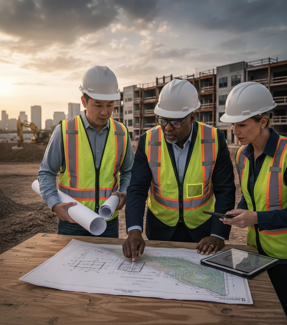
What Does an ALTA Survey and a Topo Survey Reveal?
Two surveys developers must understand are the ALTA survey and the topographic (topo) survey.
ALTA survey: Identifies property boundaries, encroachments, and easements. It ensures lenders and cities know exactly where a project begins and ends.
Topo survey: Maps the highs and lows of the land. This information determines drainage, grading, and how buildings can be placed.
Without these surveys, developers risk costly disputes or design errors that could derail approvals.
How Do Tree Surveys and Environmental Protections Affect Projects?
Tree surveys may sound simple, but they play a critical role in permitting.
Cities often require a count of existing trees and a plan for preservation or replacement.
Some trees, like heritage oaks or historically significant specimens, cannot be cut down.
Ignoring these rules can lead to fines or project delays.
Similar requirements exist for endangered species or other environmental features. Developers must show regulators they are building responsibly.
What Are Planned Development Exhibits and Why Do They Matter?
Alvin describes Planned Development (PD) Exhibits as the documents that show cities what a developer intends to build.
They cover building types, street widths, sidewalks, setbacks, and unit density.
Cities require them before providing access to water, sewer, or other utilities.
Developers must comply with local standards, even when building on privately owned land.
In other words, buying 100 acres does not give you full freedom to build whatever you want. City regulations, annexation rules, and utility access all tie back to these exhibits.
Key Insights from Alvin Hope Johnson
Phase 1 and Phase 2 ESAs protect developers from hidden contamination.
Asbestos is common in older properties but manageable with the right plan.
Geotechnical reports rarely stop a project, since they provide remedies for soil issues.
ALTA and topo surveys prevent boundary disputes and guide grading and drainage.
Planned Development Exhibits are essential for city approval and utility access.
Memorable Quotes from Alvin Hope Johnson
“Your grading plan comes from your topo, because it tells you where to cut and fill”.
“We are not soil experts. We just need to know who to call. That’s what engineers are for”.
“It is not about knowing every report. It is about having the right team so you can focus on being a developer”.
“Just because you find contaminants does not mean the deal is dead. It means you have to understand the cost of remediation”.
Common Questions Answered in This Episode
What is a Phase 1 ESA and why is it important?
It identifies potential soil contamination and determines whether a Phase 2 study is needed.
How does asbestos affect affordable housing projects?
Older buildings almost always contain asbestos. It only requires costly abatement if disturbed during renovation.
Why do I need a geotechnical report?
It confirms whether soil can support foundations and provides remedies for clay, sand, or other conditions.
What is the difference between an ALTA survey and a topo survey?
ALTA defines boundaries, while topo shows elevations and drainage patterns.
What are Planned Development Exhibits?
They are detailed plans that cities require before approving a project, covering density, setbacks, utilities, and more.

Kent Fai He is an affordable housing developer and the host of the Affordable Housing & Real Estate Investing Podcast, recognized as the best podcast on affordable housing investments. By teaming up with leaders like Alvin Hope Johnson, Kent provides developers with the knowledge and confidence to pursue projects that transform communities.
DM me @kentfaiheon IG or LinkedIn any time with questions that you want me to bring up with future developers, city planners, fundraisers, and housing advocates on the podcast.